Ankarafa Field Station,
Madagascar
Overview
In June 2017, FCBStudios were invited by Bristol Zoo to collaborate on an exciting new project on Madagascar’s Sahamalaza Peninsula to develop a new research facility within the remote Ankarafa Forest to support their research and education programme.
Working in a small team alongside landscape architects Grant Associates and engineers Buro Happold, we, on behalf of the Richard Feilden Foundation, were tasked with designing a self-sufficient camp where local researchers, international PhD students, guides and tourists could sleep, eat and work.
The existing centre is a two-hour hike from the beach village, and due to the site’s isolated position in the forest, the primary construction material is sourced from within the site boundary. Win spoil from the foundations are used to create Interlocking Stabilised Soil Blocks and assembled to form the wall construction. A triangulated secondary timber structure then supports a double-skinned palm leaf roof. Covered external walkways help to protect the soil blocks and provide shade to create a comfortable outdoor environment in which to work, relax, eat and socialise.
The Ankarafa Field Station is designed to have a very small impact on the environment, but a large impact on local communities and international understanding of lemurs and other wildlife in their natural habitat. In creating opportunities and providing a livelihood for the community, increased education provision for children and by increasing the value of the national park to the locals, a future for the indigenous wildlife will be secured.

Describe your image

Describe your image

Describe your image

Describe your image
Geographical and Topographical Context
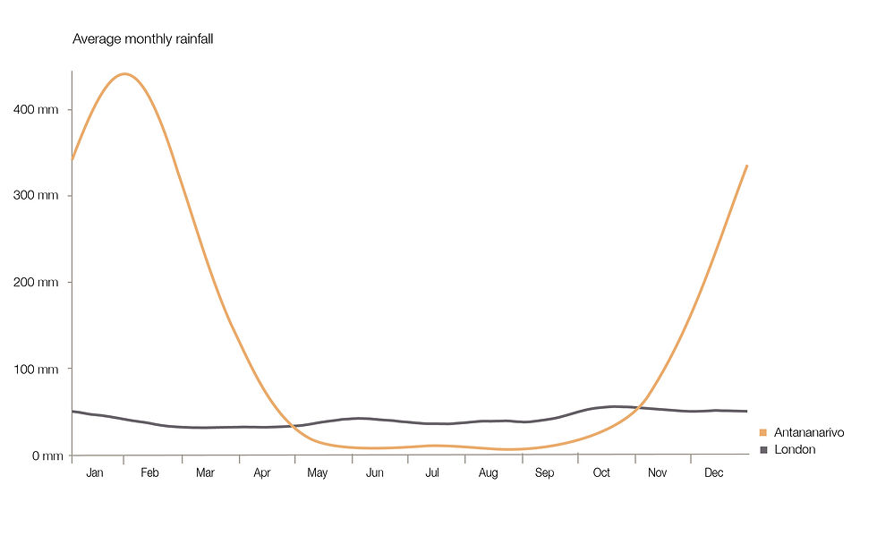
The climate of Madagascar is subtropical, with hot and rainy seasons between November and the end of March (summer), and a cooler dry season from May to October (winter).
The site is situated in the north-west region of the county where temperatures typically range from 27°C - 32°C in the wet season and 18°C - 22°C in the dry season. Wet season monsoons can deliver approximately 2000mm of precipitation annually.
Madagascar’s topography is generally described as a plateau, rising sharply from the narrow plain of the east coast and descending in a series of steps to the strip sedimentary rocks along the west coast. Along the eastern edge, significant gorges and waterfalls intent the high plateau.
There are numerous volcanic outcrops that produce heights over 1,800 m (6,000 ft); the highest point is Mount Maromokotro (2,876 m/9,436 ft) in the Tsaratanana Massif. The eastern coast is almost straight and has very few anchorages. Behind its coral beaches there is an almost continuous line of lagoons from Foulpointe to Farafangana. These are linked by manmade channels to form an inland waterway called the Pangalanes Canal. The island's major rivers flow westward and are navigable for about 160 km (100 mi) inland.
Sustainability Impact

The Ankarafa field station endeavours to fulfil many of the United Nations Sustainable Development Goals, namely:
Bioclimatic Design Principles
The Ankarafa field station is at the forefront of sustainable architecture in Madagascar; maximising passive environmental design, using materials responsibly and utilising circular economy waste management strategies.


